Weather

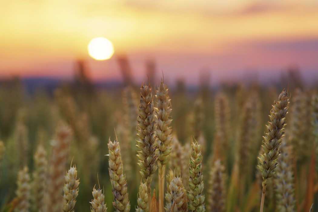
Gov. Declares Drought in Kansas, Provides Aid for Farmers

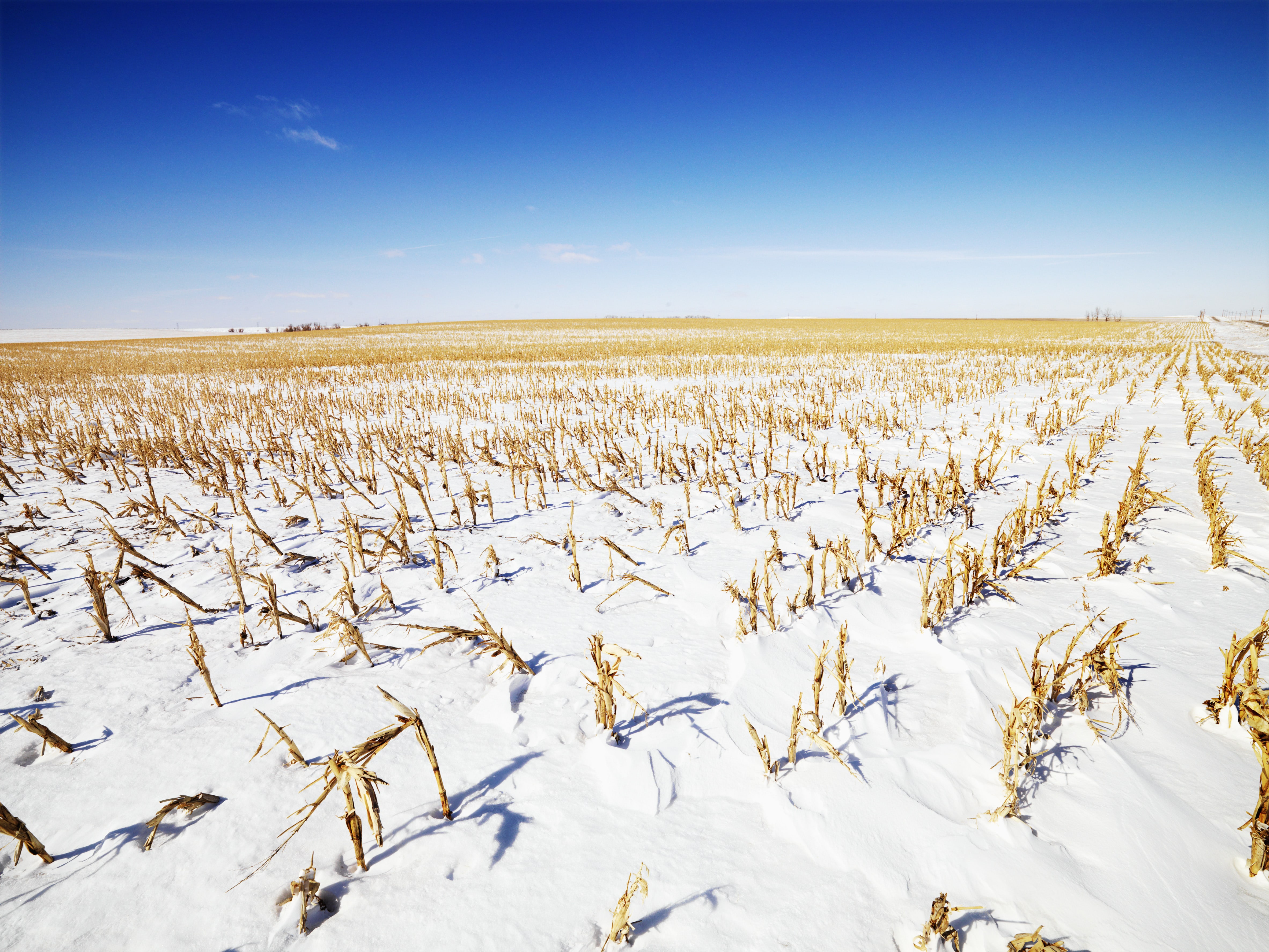
A drought declaration has been made for all 105 counties in Kansas on March 13 by Governor Jeff Colyer. The declaration would provide assistance to farmers and ranchers as they deal with drought impacting their livestock and crops. The declaration allows for disaster response by the state allowing the deployment and use of personnel, supplies, equipment, materials or facilities available to aid the drought response. Also, hauling hay to livestock in drought areas of Kansas will have a temporarily ease in particular motor carrier rules and regulations. Letters were sent by Governor Colyer to Kansas State Executive Director of the U.S. Department of Agriculture Farm Service Agency and all county executive directors encouraging them to evaluate use of Conservation Reserve Program (CRP) land. Property currently enrolled in CRP could be permitted to be hayed or grazed for livestock utilization. Additionally, haying or grazing could cut down the fuel load for fires, aiding in fire suppression should any wild fires occur. "We are hopeful this early collaboration with our federal partners will allow for immediate relief to Kansas farmers and ranchers," says Kansas Secretary of Agriculture Jackie McClaskey," and we are committed to continuing to work with all of our partners through the duration of the current drought." The latest U.S. Drought Monitor released March 15 shows 66 counties in Kansas are at D2 (Severe) or D3 (Extreme) drought levels, and 56.19% the state’s land falls into this designation. A vast majority of the state is classified as D1 (Moderate) the first drought classification with 81.77% of Kansas land fitting this description. Four counties along the Oklahoma border have the worst classification D4 (Exceptional) drought with only 0.3% of Kansas land in the classification currently. Neighboring Oklahoma is the only other state in the country with D4 (Exceptional) drought levels and 8.2% of land in Oklahoma fits this description at the moment. Last week wildfire risk in Kansas and neighboring states was elevated with high winds and dry conditions. In a two day period there were approximately 50 wildfires reported in Kansas burning at least 25,000 acres. There have been no major wildfires this year compared to the Starbuck Fire in 2017 and the Anderson Creek Fire in 2016 that burned hundreds of thousands of acres both in Kansas and Oklahoma.
Read more...

Drought Requires Immediate Action; Resources Available

Farmers and ranchers in the Southern Great Plains are in a drought with conditions worsening since November. While the drought affects many of the contiguous states, the states experiencing the worst conditions are Oklahoma, Texas, Arizona and Kansas. According to the current United States Drought Monitor, the entire state of Oklahoma is in at least a severe drought; more than 80 percent of the state is considered either in a severe or extreme drought. South of the Red River, 90 percent of Texas is in some level of drought, from abnormally dry to extreme drought. "Producers need to have contingency plans in place now to help decision-making easier as we move through the spring," says Hugh Aljoe, director of producer relations. "Even with rain in the short-term forecast, we are expecting the conditions to worsen through the spring." Noble agricultural consultants advise producers to immediately assess water and forage sources. Farmers and ranchers should match expected forage production and water quantity with animal demand, which may lead to destocking of cattle herds. As drought conditions continue, farmers and ranchers should consider taking immediate steps, such as buying hay while it is still available and culling cows, to help mitigate further impacts to their operations. Historically, cattle prices decline and supplemental feed costs increase the longer a drought persists. "It is important that farmers and ranchers gather their information and take steps as soon as possible," Aljoe said. "Keeping close records and knowing production costs is important in making timely and effective management decisions." For up-to-date drought management information, the Noble Research Institute has developed a special web page (www.noble.org/drought) to serve as a central source for resources to assist agricultural producers throughout this difficult situation. Timely management tips will also be provided on the organization’s social media channels.
Read more...

Winter's Harsh Cold May Recede for A While

Body: AccuWeather reports while winter's deep freeze is taking a break across the United States, there is a chance the brutally cold conditions experienced during early January may return in the weeks ahead. The air moving in behind a blizzard over the North Central states is not abnormally cold and not of arctic origin. While chilly, this air originated from the Pacific Ocean and southern Canada. Temperatures are forecast to merely dip to within a few degrees of average for a couple of days from the northern and central Plains to the Midwest and Northeast. During late January, the average high is 24 F in Minneapolis, 32 F in Chicago, 36 F in Pittsburgh, 38 F in New York City, 43 F in Washington, D.C., and 35 F in Boston. However, it will feel significantly colder over the northern areas due to a gusty wind initially. From the peak of the warmth on Monday in the Midwest and Tuesday in the coastal Northeast, AccuWeather RealFeel® Temperatures are forecast to be 25 to 40 degrees Fahrenheit lower on Tuesday and Wednesday respectively. "In the South, the new chilly push will have much less bite, since the snowcover has been erased," according to AccuWeather Lead Long-Range Meteorologist Paul Pastelok. Another warmup will follow later this week over the Central states and this weekend in the East with temperatures likely to climb into the 40s and 50s across the north and the 60s and 70s across the south. "Another cycle of back-and-forth cold and warm conditions is likely to follow during the last couple of days of January and the first couple of days of February," Pastelok said. Overall, temperature swings will be less dramatic in the South, as compared to the north. Most days across the southern third of the nation will bring near- to above-average temperatures. Much of the lower 48 states should get a break from the harsh cold for 10-14 days. The nation may not be done with lasting, harsh cold, however. "There are signs that the first major discharge of arctic air may develop in less than two weeks," Pastelok said. "It could be a double shot with the second one perhaps being the most severe." At this time, it appears that the next major thrust of cold air may first enter the Northwest or the Central states and progress eastward into the middle of February. Storms with snow may precede and accompany the next major wave of cold air over the Midwest and interior Northeast. It is possible one of these storms may affect Minnesota and the Minneapolis area during Super Bowl weekend. The details as to exactly how extensive and lasting the cold air becomes and the track of the storms may not be revealed for another week or more. AccuWeather will continue to provide updates on the long-range outlook for February in the U.S.
Read more...

La Nina Could Pressure Yields

Producers can expect La Niña to continue making itself known during the first few months of 2018. The outlook for January and February, in particular, will be heavily influenced by La Niña, which is expected to continue through late winter, according to the National Weather Service. La Niña favors above-normal temperatures for the majority of the continental U.S. Portions of the Southwest and Texas have the highest probability of warmer-than-normal conditions, says Stephen Baxter with the National Oceanic and Atmospheric Administration. The outlook is largely unchanged from previous reports, except the Weather Service now sees a decrease in above-normal temperatures for portions of the south-central U.S. and a slightly higher chance of below-normal temperatures over the Northern Plains and Upper Midwest. Temperature Outlook. The influence of La Niña could be a challenge for row-crop producers in the year ahead, cautions Elwynn Taylor, Extension climatologist at Iowa State University. “La Niña is not our friend in this part of the U.S.,” says Taylor, speaking to farmers at a recent event in Iowa. He notes there is a 70% chance of a below-trendline yield. “We get exactly the amount of rain we need if we have an average year,” he says. “But if we’re 5% drier than normal, we have a problem.” For centuries, data has shown producers tend to experience 18 years of weather stability and 25 years of volatile times, Taylor says. The U.S. is in the latter cycle. “Prepare for that type of management, knowing we’re going to have high volatility,” he says. Another weather trend that has been documented for more than 600 years shows that on average, every 89 years brings the worst year of the century, Taylor adds. States such as Iowa and Illinois most recently experienced their worst year in 1847. Eighty-nine years later, the Dust Bowl devastated the Plains, peaking in 1936. “If this continues, we can expect to have the worst year of this century in 2025,” Taylor says. Producers should compare their own annual yields to their county’s trendline yields and insure bushels where volatility is greatest. “If your farm is consistent, insure the county,” Taylor says. “If your farm is volatile compared to the county, insure your farm.” Paying attention to growing degree days also can help determine what type of yields you can expect. The best yields tend to occur when growing degree days develop a below-normal deficit of 100 between silking and dent stages. “Whether we are ahead or behind growing degree days after silking, you’ll know the yield,” Taylor says.
Read more...

Billion Dollar Disasters Hammered Farm Country Last Year

Two years ago, Andle van der Ploeg, owner of Mid-Frisian Dairy near Clovis, N.M., experienced the worst blizzard of his life. The freak storm, named Goliath, hit on Dec. 28, 2015, and resulted in tens of thousands of dead cows in the region. Van der Ploeg says storms like Goliath teach you something: resiliency. What a year 2017 has been for learning that lesson. From delayed planting due to snow in parts of the Corn Belt, to wind, rain, hurricanes and fire's fury in other areas, the resiliency of farm country was tested this year. Severe weather woes started early as dozens of tornadoes hit the southeast in January, including Alabama, Florida, Georgia, Louisiana and Mississippi. Tornadoes accounted for seven billion-dollar weather events in 2017, according to the National Oceanic and Atmospheric Administration's (NOAA) National Centers for Environmental Information. February brought floods. California suffered extreme flooding as much-needed rain caused the Feather River to flow beyond its banks. More than 382,000 acres of farmland and fields in the Sacramento Valley were submerged, some for several months. In March, a late frost preceded by weeks of warm weather damaged fruit and vegetable crops in the southeast. According to Georgia Agriculture Commissioner Gary Black, farmers took a $300 million hit from the loss of peaches and blueberries alone. One other flooding event made NOAA's list of billion-dollar disasters. In late April and early May, a series of storms in Missouri and Arkansas halted planting as more than 11" of rain fell. At the same time, winter storm Ursa dropped heavy snow in the Plains. Parts of Kansas, Nebraska, Oklahoma and Texas saw blizzard conditions with 9" to 18" of snow. Severe drought also took its toll. NOAA estimates the ongoing drought in Montana and the Dakotas has resulted in roughly $2 billion in damages. Fueled by the lack of rain, fire's fury swept across Oklahoma, Kansas and Texas. Thousands of cattle died and were displaced, and the fires left billions of dollars of damaged grassland, hay and wheat fields in their wake. Later, another round of wildfires roared through Montana and California, wiping out wineries and cannabis farms in Sonoma County. Hurricanes Harvey and Irma also left their mark on U.S. agriculture. Harvey made landfall in Texas in late August just as corn, cotton and rice harvest was wrapping up. The South Texas Cotton and Grain Association reports the final tally on crop losses could reach $150 million. Cotton farmers in the Upper Coastal Bend were some of the hardest-hit, according to the Texas Department of Agriculture. There, hundreds of cotton modules were blown apart by gale-force winds and many more were left lying wet in fields and at gin yards. Fortunately, Texas rice producers had already harvested around 75% of the crop before the storm hit, but storage bins suffered extensive wind and water damage resulting in additional crop loss. Hurricane Irma took a toll on fruit and vegetable crops. "We had a lot of specialty peppers, eggplants and tomatoes in the ground, and we had just planted some summer squash," recalls Steve Veneziano, vice president of sales and operations at Oakes Farms Inc., Naples, Fla. Those crops were lost. Dairies in Florida also suffered damage. On H.C. Dairy Farm in Lakeside, east of Tampa, a freestall barn collapsed and took rescue crews several days to get 400-plus milk cows out of the rubble. Jerry Dakin, owner of Dakin Dairy Farms, says most of their milk goes to the southern part of the state where many stores had no power. Many area farms were forced to dump milk because trucks didn't show up to take it. Dakin estimates the losses ran $30,000 per day from dumping milk. At the very tale-end of the year, wildfire engulfed much of California. "A historic firestorm damages or destroys over 15,000 homes, businesses and other structures across California in October," NOAA reported in their January 2018 update of the disaster list. "The combined destruction of the Tubbs, Atlas, Nuns and Redwood Valley wildfires represent the most costly wildfire event on record, also causing 44 deaths. Extreme wildfire conditions in early December also burned hundreds of homes in Los Angeles." Webster defines resiliency as the capacity to recover quickly from difficulties, and farmers possess that quality in spades. The road to recovery for many will not be a quick one, but there's no doubt U.S. farmers and ranchers are up to the task. Weather events across the U.S. this year did more than $15 billion worth of damage to crops, livestock and farm property, according to NOAA's National Centers for Environmental Information.
Read more...

Two years ago, Andle van der Ploeg, owner of Mid-Frisian Dairy near Clovis, N.M., experienced the worst blizzard of his life. The freak storm, named Goliath, hit on Dec. 28, 2015, and resulted in tens of thousands of dead cows in the region. Van der Ploeg says storms like Goliath teach you something: resiliency. What a year 2017 has been for learning that lesson. From delayed planting due to snow in parts of the Corn Belt, to wind, rain, hurricanes and fire's fury in other areas, the resiliency of farm country was tested this year. Severe weather woes started early as dozens of tornadoes hit the southeast in January, including Alabama, Florida, Georgia, Louisiana and Mississippi. Tornadoes accounted for seven billion-dollar weather events in 2017, according to the National Oceanic and Atmospheric Administration's (NOAA) National Centers for Environmental Information. February brought floods. California suffered extreme flooding as much-needed rain caused the Feather River to flow beyond its banks. More than 382,000 acres of farmland and fields in the Sacramento Valley were submerged, some for several months. In March, a late frost preceded by weeks of warm weather damaged fruit and vegetable crops in the southeast. According to Georgia Agriculture Commissioner Gary Black, farmers took a $300 million hit from the loss of peaches and blueberries alone. One other flooding event made NOAA's list of billion-dollar disasters. In late April and early May, a series of storms in Missouri and Arkansas halted planting as more than 11" of rain fell. At the same time, winter storm Ursa dropped heavy snow in the Plains. Parts of Kansas, Nebraska, Oklahoma and Texas saw blizzard conditions with 9" to 18" of snow. Severe drought also took its toll. NOAA estimates the ongoing drought in Montana and the Dakotas has resulted in roughly $2 billion in damages. Fueled by the lack of rain, fire's fury swept across Oklahoma, Kansas and Texas. Thousands of cattle died and were displaced, and the fires left billions of dollars of damaged grassland, hay and wheat fields in their wake. Later, another round of wildfires roared through Montana and California, wiping out wineries and cannabis farms in Sonoma County. Hurricanes Harvey and Irma also left their mark on U.S. agriculture. Harvey made landfall in Texas in late August just as corn, cotton and rice harvest was wrapping up. The South Texas Cotton and Grain Association reports the final tally on crop losses could reach $150 million. Cotton farmers in the Upper Coastal Bend were some of the hardest-hit, according to the Texas Department of Agriculture. There, hundreds of cotton modules were blown apart by gale-force winds and many more were left lying wet in fields and at gin yards. Fortunately, Texas rice producers had already harvested around 75% of the crop before the storm hit, but storage bins suffered extensive wind and water damage resulting in additional crop loss. Hurricane Irma took a toll on fruit and vegetable crops. "We had a lot of specialty peppers, eggplants and tomatoes in the ground, and we had just planted some summer squash," recalls Steve Veneziano, vice president of sales and operations at Oakes Farms Inc., Naples, Fla. Those crops were lost. Dairies in Florida also suffered damage. On H.C. Dairy Farm in Lakeside, east of Tampa, a freestall barn collapsed and took rescue crews several days to get 400-plus milk cows out of the rubble. Jerry Dakin, owner of Dakin Dairy Farms, says most of their milk goes to the southern part of the state where many stores had no power. Many area farms were forced to dump milk because trucks didn't show up to take it. Dakin estimates the losses ran $30,000 per day from dumping milk. At the very tale-end of the year, wildfire engulfed much of California. "A historic firestorm damages or destroys over 15,000 homes, businesses and other structures across California in October," NOAA reported in their January 2018 update of the disaster list. "The combined destruction of the Tubbs, Atlas, Nuns and Redwood Valley wildfires represent the most costly wildfire event on record, also causing 44 deaths. Extreme wildfire conditions in early December also burned hundreds of homes in Los Angeles." Webster defines resiliency as the capacity to recover quickly from difficulties, and farmers possess that quality in spades. The road to recovery for many will not be a quick one, but there's no doubt U.S. farmers and ranchers are up to the task. Weather events across the U.S. this year did more than $15 billion worth of damage to crops, livestock and farm property, according to NOAA's National Centers for Environmental Information.
Read more...

Harsh Cold, Biting Winds to Threaten Midwest, Northeast into Weekend

AccuWeather reports despite already experiencing some of their coldest weather in recent years, residents of the Midwest and Northeast will need to brace for another round of arctic air by Friday. The arctic air will blast into the region behind the blizzard that hammered the coastal Northeast on Thursday. This new wave of cold air will be close to the level of cold experienced at the end of 2017 and start of 2018 in the Midwest, central Appalachians and interior South. Actual temperatures may reach their lowest point of the season so far in coastal areas of the Northeast, such as in Washington, D.C., Philadelphia, New York City and Boston. AccuWeather RealFeel temperatures may be lower in some cases, especially in parts of the Northeast due to winds from the departing storm. Temperatures are anticipated to bottom out Friday through Saturday. Temperature readings are not likely to exceed the single digits on Friday from Minneapolis to Indianapolis; Albany, New York; and Burlington, Vermont. High temperatures in coastal areas of the Northeast are expected to be in the teens in many areas. "On Saturday, Boston will challenge its lowest maximum temperature ever recorded for the date, which stands at 7 from 1896," said AccuWeather Meteorologist Renee Duff. A biting wind will accompany these frigid conditions, making it feel even colder. In the ski country of northern New York and New England, AccuWeather RealFeel Temperatures will be a brutal 30 degrees Fahrenheit below zero throughout the day on Friday. It will be important for anyone venturing outside to cover every inch of skin, utilizing hats, mittens, scarves and balaclavas or face masks. "If not adequately dressed in such conditions, the risk of frostbite is high, even if you spend less than 15 minutes outdoors," Duff warned. At least 17 deaths have been linked to the brutally cold weather which has gripped the nation, the Associated Press reported. Pets and other animals should not be left without proper shelter from the cold and wind in these conditions. Anyone who may lose power due to the powerful storm should make every effort to stay in a warm location until power is restored. The wind will also be strong enough to result in property damage, power outages and travel delays across the region. Airline delays at major hubs may ripple across the nation, causing further delays even outside of the Midwest and Northeast. As cold winds whip over the region, another round of lake-effect snow will ramp up downwind of the Great Lakes. Several inches of fresh snow and frequent white-out conditions will again make travel dangerous across the area. "For those who find the brutal cold unbearable and downright miserable, there is some hope on the horizon," Elliott said. Early next week, an approaching storm will cause the bitter cold to retreat toward Canada, allowing temperatures to return to near-normal levels for a brief time, according to Elliott.
Read more...

Milder Air to Surge into Midwest, Northeast as Polar Vortex Shifts

AccuWeather reports a break from the waves of cold air hammering the Midwest and Northeast is on the way, but it will not be until next week. While record warmth is in store for the West and parts of the Plains this week, waves of cold air from the polar region will intervene farther east through this weekend. "Another significant blast of cold air with wind will rotate through from the Midwest to the Northeast from Saturday to Monday," according to AccuWeather Lead Long-Range Meteorologist Paul Pastelok. Cold winds may make venturing out a little painful this weekend. The best bet for a few days in a row with temperatures near or above average will be early next week for the North Central states and the middle of next week in the Northeastern states. Temperatures are likely to reach the 40s to lower 50s F in Chicago and New York City for a few days next week. The less harsh conditions expected will allow people who mind or cannot handle the cold to get outside as holiday shopping and outdoor decorating kick into high gear. "The coldest air in the Northern Hemisphere, relative to average, is likely to be centered over parts of Europe and Asia during the first part of December, due to the anticipated position of the Polar Vortex," Pastelok said. The Polar Vortex is a storm high in the atmosphere that typically hangs out near the North Pole. When this storm is strong, it tends to keep frigid air contained around the Arctic Circle. However, when the storm weakens, it can become displaced and allow frigid air to plunge into the mid-latitudes in North America, Europe or Asia. "There is still room for part of the Polar Vortex to stretch toward the Hudson Bay, Canada, area during the first half of December," Pastelok said. If this occurs, then waves of cold air will resume in the North Central and Northeastern states during early December. "However, these cold shots would likely be rather short in duration and not as potent as the blast coming in this weekend," Pastelok said. "One thing we are very confident of is above-average warmth for much of the West and southern Plains into the first half of December." Temperatures from the Ohio Valley to the mid-Atlantic may not be too far from normal during the first part of December when averaging the approximate two-week period. The air is still likely to be cold enough for brief episodes of lake-effect snow around the Great Lakes to the central and northern Appalachians during early December. If cold air plunges again, the ingredients may be present for a storm to develop near or along the East Coast during the Nov. 30 - Dec. 1 time frame. Wintry weather could not be ruled out if all of the right factors come together.
Read more...